- Community
-
- About Sherwood Sherwood Heritage Center Chamber of Commerce Marjorie Stewart Center Sherwood Center for the Arts Sherwood YMCA Family Resources
- Events and Activities City Calendar Library Events Community Events Event Permits Monument Posting Request Community Meeting Rooms Recreation Parks and Trails Directory Recreation Programs Sherwood Fieldhouse
- Community Field House Sherwood Demographics Sherwood School District Sherwood Youth Sports Utilities Volunteer Opportunities Highway 99 Pedestrian Crossing Public Safety Police Tualatin Valley Fire & Rescue
-
- Business & Development
- Government
-
- City Council Boards and Committees Urban Renewal Agency Agendas and Minutes Municipal Code Public Records
- Building City Attorney City Manager Code Compliance Community Development Community Services Economic Development Emergency Management Engineering
- Finance Human Resources Library Municipal Court Parks & Recreation Planning Police Public Works Utility Billing
-
- Online Services
-
- Job Opportunities Utility Billing Alerts & Notifications Email Subscriptions Sherwood Flash Alert Police Flash Alert Events and Meetings Agendas and Minutes Calendar
- Contact the City Submit a Request or Concern City Offices Municipal Code Documents and Forms Documents and Reports Forms and Applications
- Social Media
-
Land Use Applications and Checklists

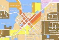
Land Use is regulated by Title 16 of the Sherwood Municipal Code, also known as the Sherwood Zoning and Community Development Code. Use the Land Use Application Form to submit an application for the following. Planning fees for land use applications can be found at the bottom of this page.
Land Use Applications submitted to the Planning Department that have been deemed complete and are in review can be found on the Current Land Use page. Projects that have been approved will remain until the plat has been recorded and/ or the project has received final approval from the Building Department.
Annexation into the City of Sherwood has a formal process that may be initiated by the City or by individuals with property in the Urban Growth Boundary. Property owners who wish to be annexed into the City need to submit a Land Use Application Form with the information required per the Checklist for Annexation Packet.
A Conditional Use Permit (CUP) allows the City to consider special uses which are not allowed outright within a zone through a public hearing process. A Conditional Use Permit is required for a change in use or the expansion of a legal non-conforming use if the proposed changes would increase the size, square footage, seating capacity or parking of existing permitted improvements by 20% or more.

In the City of Sherwood an individual is allowed to operate certain types of businesses from their residence per Sherwood Zoning and Community Development Code Chapter 16.42.
Minor land partitions divide one parcel of land into two or three parcels of land. The applicant must submit a land use application and other submittal requirements. The application preliminary plat approval must comply with applicable zoning regulations, must dedicate all common improvements, including streets, parks, floodplains, sanitary sewer, storm water, and water supply systems.
A comprehensive plan amendment is any change to the text or maps of the City of Sherwood’s adopted Comprehensive Plan. A comprehensive plan amendment usually deletes, supplements, changes the text, or modifies the land use map designations. Comprehensive plan amendments are legislative changes to the City’s long range planning documents and require public hearings before the City’s Planning Commission and City Council. This is a Type V land use process. The City Council makes all final decisions on a comprehensive plan amendment.

Persons wishing to open a Medical Marijuana Dispensary (MMD) must first apply to the Oregon Health Authority (OHA) and receive verification of registration and intention to comply with OHA rules. In addition to the States rules, Medical Marijuana Dispensaries cannot be larger than 3000 square feet, are restricted to industrially zoned property and must maintain 1000 foot buffer from school and parks (
Planned Unit Developments (PUD) include the development of land through an overall site design on a single parcel of land or multiple properties under one or more ownerships. The PUD process allows creativity and flexibility in site design and review which cannot be achieved through a strict adherence to existing zoning and subdivision standards. Planned Unit Developments are subject to review and hearings by both the Planning Commission and the City Council. The City Council makes the final decision on the Preliminary Planned Unit Development.

Pre-application conferences are encouraged and are scheduled to provide the applicant with information and procedural requirements for land use and development. Use the Pre-application Form found in the Pre-Application Packet to schedule a meeting. Meetings are generally held on Thursday afternoons and are set a minimum of 14 days out to provide time for staff to review.
Property line adjustments move one or more property boundary lines between two or more lots. No new lots will be created and the adjusted lots must continue to meet existing zoning regulations. A property line adjustment may be processed at the same time as another development application or by itself. If approved by the City, the applicant must submit the adjusted property line(s) to the County according to their requirements. The applicant needs to then submit the recorded property line adjustment survey map to the City within 30 days after recording it with the County.

A sign identifies, describes, or illustrates and directs attention to a product, place, activity, person , institution or business. There are basically two types of signs: Permanent or Temporary (includes portable, banner, and temporary signs.
Depending on the size and materials the sign is made of, a building permit may be required. If you are unsure if a Building Permit is required, contact the Building Department at 503.625.4226.
Site Plan Review, is a process by which development for Commercial, Industrial, Public and Institutional, and other similar proposed developments undergo to determine whether or not they satisfy the standards of the Sherwood Zoning and Community Development Code as it applies to uses, dimensions, parking requirements, landscaping, and other applicable standards. Site Plan review is conducted by staff, the Hearings Officer, or the Sherwood Planning Commission depending on the size and complexity of the development.
Subdivisions are the division of land into more than three (3) lots. Subdivisions are generally governed by Chapter 92 of the Oregon Revised Statutes. Specific subdivision design standards such as lot size, block length, and other dimensional requirements are left to the City to implement. Subdivisions go through a preliminary review that may be conducted by staff, the Hearings Officer, or the Sherwood Planning Commission depending on the proposed number of lots.

Temporary Uses are generally short-term or seasonal in nature and do not make permanent changes to the site. Because they have the potential to have adverse impacts on the surrounding property there are certain requirement related to Temporary Uses. Temporary Uses that have a Special Event Permit from the City or short-term events less than two weeks (that meet certain criteria) are not required to obtain a Temporary Use Permit.
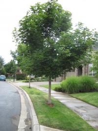
The City of Sherwood is committed to preserving, enhancing and maintaining its urban forest. The city's trees provide an important backdrop for life in Sherwood.
Though the city does not encourage removal of trees, sometimes it is necessary. This is especially true when trees are considered hazardous or in poor condition. If you are unsure of the condition of your tree, we recommend that you have a certified arborist take a look at it. If it is determined that a tree must be replaced follow the steps below.
A variance is a tool that allows an exception to certain development standards such as setbacks, building height, lot dimensions and other similar Code requirements. Variances are generally intended to apply to property with special circumstances and constraints including size, shape, topography, location or surroundings. A variance is used when strict application of the zoning ordinance deprives such property of privileges enjoyed by other property in the vicinity and the same zoning classification.

Wireless communication facilities for radio, television and similar communication stations, including associated transmitters generally require a conditional use permit and approval as described below. If there is an existing approved tower or facility and an applicant requests to add an antenna to the facility or “co-locate” on an existing tower or on an existing building or structure not to exceed the roof of the structure, the application will be processed as Type I administrative decision.

A comprehensive list of all City fees can be in the Fee Schedule. The City accepts cash, check, MasterCard or Visa. For any questions about fees, please call the Sherwood Planning Department at 503-925-2308.
A zoning verification letter is a document provided by the City to verify the current zoning of a site with a summary of the allowable uses within the zoning classification.
The zoning verification letter provided will contain the following information:


