Map Catalog
Below is a catalog of maps that can be downloaded and printed out. Each map is maintained on a slightly different schedule based on data changes. If you would like to access data in an interactive environment visit the Interactive Map.
Member
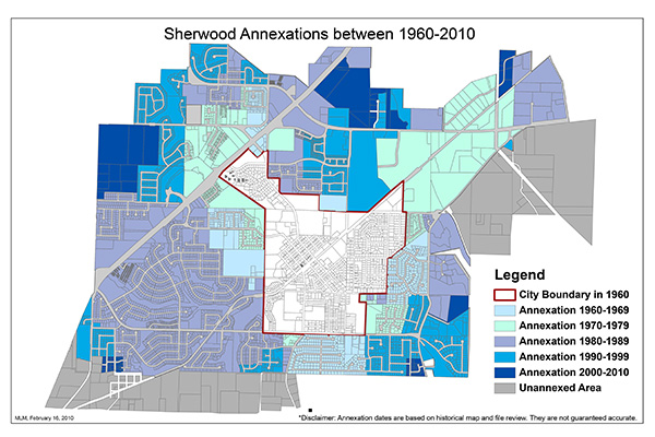
The Sherwood Annexation History Map is provided by the Planning Department. For more information please contact Planning at (503) 925-2308.
This is the Elementary School Boundary within the city limits.
If you are unsure which boundary you are in you can also access the information directly from the school districts website
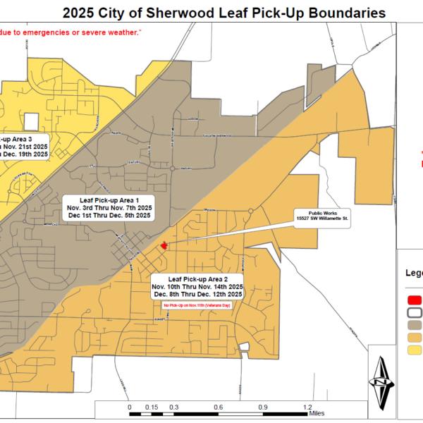
View a map of the areas and dates that the crews will be picking up leaves to keep them out of the storm drains. Download a larger version below.
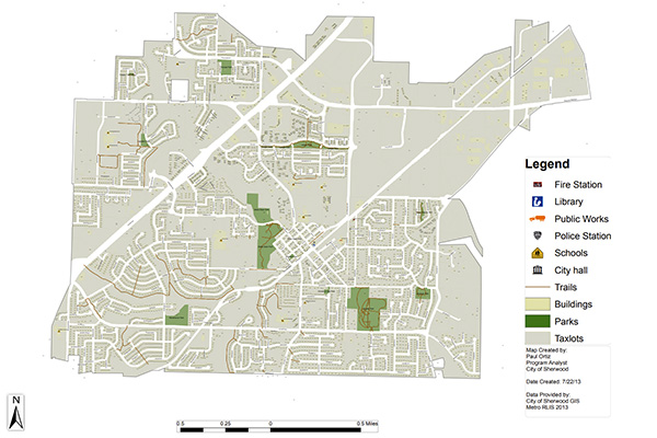
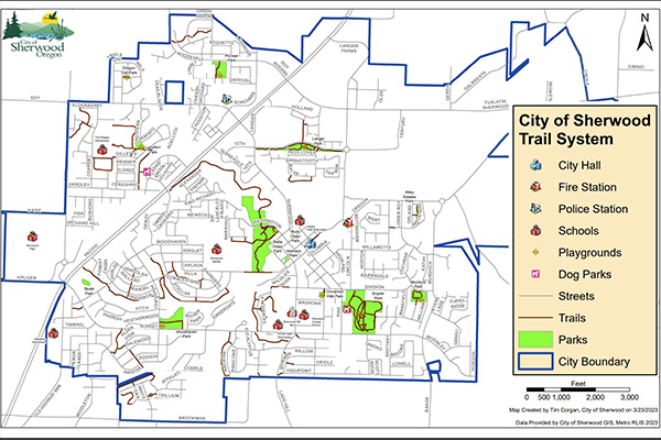
This map is of the City of Sherwood. It contains schools, streets, addresses, tax lots, parks, and trails. Trails have been one thing a number of residents have requested. The trails include city maintained as well as some HOA maintained.
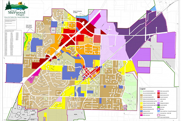
The Sherwood Zoning Map is provided by the Planning Department. For more information please contact Planning at (503) 925-2308.
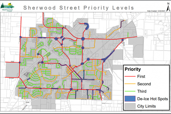
During the worst icy weather our Public Works Crews go into action to spread sand on or plow the major roads to make them safe for our residents. Please download the Street Priority Map at the link below to see how the City prioritizes the roads and chart your course accordingly if you have to go out.
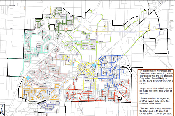
Attached is a map that details the new schedule of what streets will be serviced on which days. In the event that a day’s service gets missed due to a holiday, weather challenges or equipment issues we will reschedule that day’s route to the next available day of the following week.
Sweeping will occur Mondays through Thursdays in the first 2 weeks of the month. This schedule may occasionally be altered to correspond with other seasonal activities, like the Curbside Leaf Pick Up Program and winter weather activities.
Ultimately, the goal is to sweep every city street once a month.
If you have questions about the program please call the Public Works Department at (503) 625-5722 or email operations@sherwoodoregon.gov
Sherwood has many trails worth exploring. Below is a link to access a map of the trails hidden throughout the City.
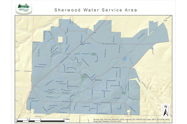
Click on the interactive map link on this page for the best view of the Water Service area.
Click on the image to see a larger view of the Water Service area map.
Click on the supporting document link below to download a .pdf map. The file will take a while to download depending upon your connection speed.
If you want to know if your address is serviced by the City of Sherwood, call the Utility Billing Department at (503) 925-2315.
The City of Sherwood is providing the GIS for the public to be able to access information as needed. This data has always existed and been obtainable by any public citizen, however it is now readily available upon user demand through GIS.
Our mission is to provide up to date public information in a easy to use interface. Providing everyone access to the information, not just the experts.
Disclaimer
The City of Sherwood’s infrastructure records, drawings, and other documents have been gathered over many years, using many different formats and standards. While the data provided is generally believed to be accurate, occasionally it proves to be incorrect; thus its accuracy is not guaranteed. Prior to making any property purchases or other investments based in full or in part upon the material provided, it is specifically advised that you independently field verify the information contained within our records.
Web Links


 Welcome to the City of Sherwood’s Notification System, the city’s latest tool for providing residents with immediate information and warnings on water contamination, extreme weather warnings, unexpected road closures, etc. This is a free service provided by the City of Sherwood.