
Brookman Road Concept Plan
Project Type: Land Use
Brookman Road Concept Plan
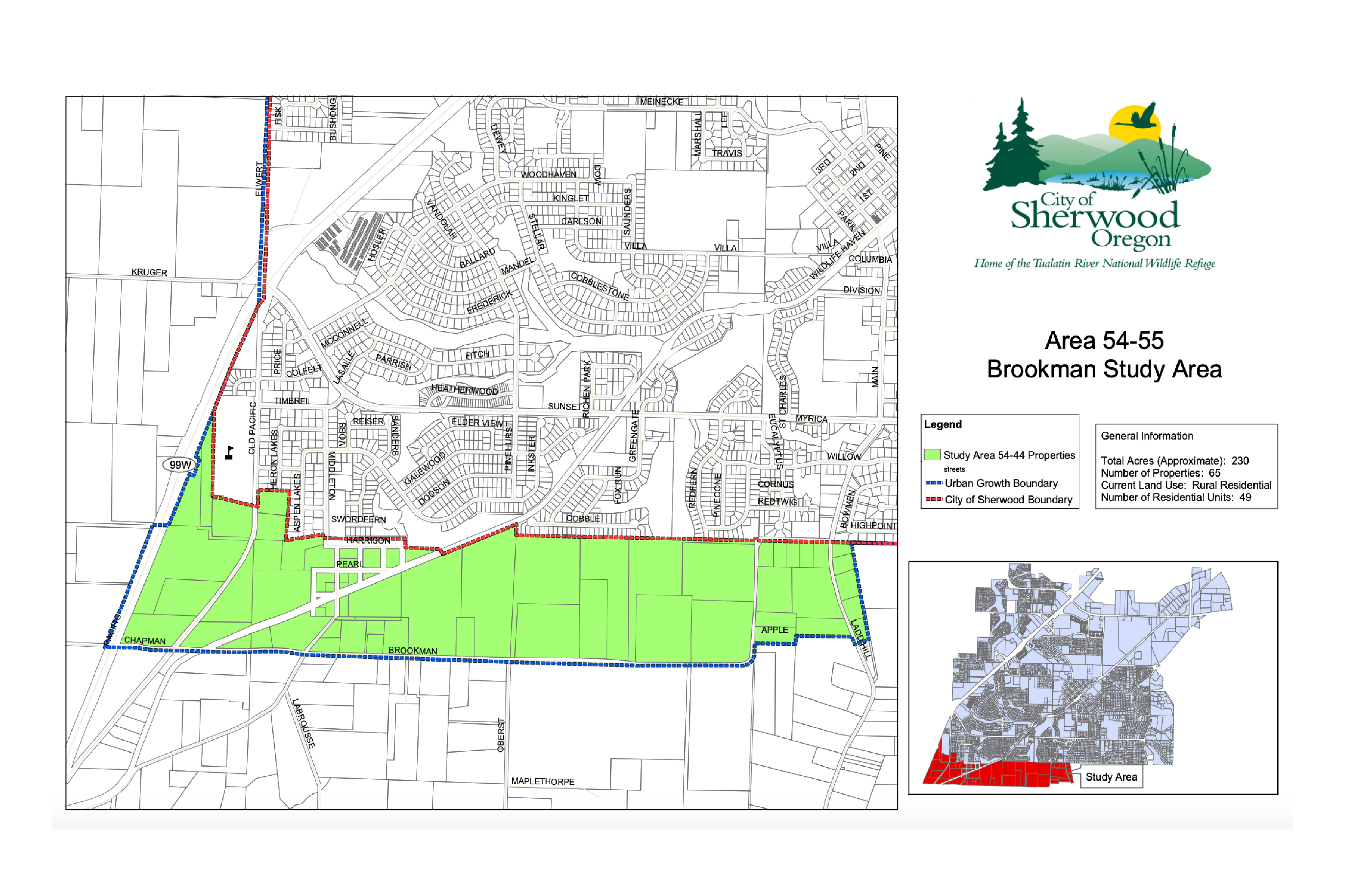
The City worked for over a year to develop the concept plan for the “Brookman Road Concept Plan.” This area was brought into the Urban Growth Boundary by Metro in 2002 in order to accommodate an identified region wide need for additional land. The Concept Plan study area boundaries include the existing city limits to the north, Brookman Road to the south, Highway 99W to the west, and properties located due east of Ladd Hill Road. The study area encompasses roughly 235 acres of rolling hills, floodplains, secondary forests, the former railroad station town of Middleton, and multiple rural residential properties.
The concept planning effort included a comprehensive review of the existing inventory of land use, Goal 5 resources, transportation and public facilities, a market study, and surveyed the needs of current residents and property owners. The project also identified future land uses, public facilities, including parks and open space, civic uses, and transportation corridors.
The Brookman Concept Plan was adopted by the City Council in June 2009 and became final on April 5, 2010.
Until annexation occurs, the Brookman area will remain in unincorporated Washington County.
The property remains in the County (and under County zoning) until annexation into the City of Sherwood. At the time of annexation the comprehensive plan zoning would be applied.
Updated – June 13, 2019 Staff contact
Supporting Documents
 Map of Project Area
Fiscal Analysis Memo
Appendix D - Water Sanitary Sewer
Appendix C - Stormwater
Appendix F - Existing Conditions
Appendix G - Acknowledgements
Appendix E - Fiscal Impacts Analysis
Appendix 5 9 08
Appendix a - Public Involvement Report
Adopted Comp. Plan Zoning M Ap
Appendix B - Transportation
Brookman Addition Concept Plan May 2009
Map of Project Area
Fiscal Analysis Memo
Appendix D - Water Sanitary Sewer
Appendix C - Stormwater
Appendix F - Existing Conditions
Appendix G - Acknowledgements
Appendix E - Fiscal Impacts Analysis
Appendix 5 9 08
Appendix a - Public Involvement Report
Adopted Comp. Plan Zoning M Ap
Appendix B - Transportation
Brookman Addition Concept Plan May 2009
 Welcome to the City of Sherwood’s Notification System, the city’s latest tool for providing residents with immediate information and warnings on water contamination, extreme weather warnings, unexpected road closures, etc. This is a free service provided by the City of Sherwood.